CP 2045 Circulation

Share CP 2045 Circulation on Facebook Share CP 2045 Circulation on Twitter Share CP 2045 Circulation on Linkedin Email CP 2045 Circulation link

Cochise County’s Circulation Plan guides how people and goods move safely and efficiently throughout the county. It covers roads, highways, public transit, rail, airports, and bicycle and pedestrian routes. The plan is not a construction schedule, but a long-term vision for safe, efficient, and connected transportation through 2045.

The plan helps the County:

  • Maintain and improve roads
  • Support safe, efficient travel for residents, visitors, and businesses
  • Expand biking, walking, and transit options
  • Coordinate with regional, state, and federal transportation initiatives
  • Integrate transportation planning with land use, economic growth, and community priorities


THE CIRCULATION NETWORK

  • Roadways – Managed by federal, state, municipal, and county agencies. Includes public and private roads, with maintenance schedules for paved, dirt, and primitive roads.
  • Railroads – Active, inactive, and abandoned rail corridors preserved for freight, trails, or heritage tourism. Future passenger rail connections are monitored.
  • Public Transit – Fixed-route and demand-response systems in Sierra Vista, Douglas, Benson, Bisbee, Willcox, and Huachuca City. Includes the Cochise Connection linking our cities.
  • Airports – Nine airports support general aviation, emergency services, military, and economic activity.
  • Bicycle & Pedestrian Routes – Urban networks of bike lanes, sidewalks, and trails; rural routes include U.S. Bicycle Route 90 and the Sun Corridor Trail for recreation, commuting, and tourism.
  • Partnerships & Improvement Districts – Public-private partnerships and Road Improvement Districts help fund and improve roads collaboratively.


CIRCULATION GOALS & KEY POLICIES

GOAL 1: Preserving Rails, Promoting Mobility

  • Maintain and preserve active, inactive, and historic rail corridors
  • Explore rail-banking, trails, or utility uses while keeping future rail options open
  • Support freight connectivity and heritage tourism

GOAL 2: Aviation for Growth and Access

  • Maintain and enhance county airports for general aviation, training, and emergency services
  • Coordinate with municipal, military, and educational airports for safe, integrated operations
  • Support improvements that benefit tourism, business, and training while protecting surrounding areas

GOAL 3: Move by Foot and Wheel

  • Expand safe, connected bicycle and pedestrian networks
  • Integrate regional trails like U.S. Bicycle Route 90 and the Sun Corridor Trail
  • Partner with local, regional, and state organizations to plan and fund improvements

GOAL 4: Connect Through Transit

  • Maintain and improve fixed-route and demand-response transit, including the Cochise Connection
  • Ensure countywide coordination and equitable access for seniors, riders with disabilities, and low-income residents
  • Facilitate regional connections, including links to Sonora, Mexico

GOAL 5: Paving the Way Forward

  • Regularly evaluate and prioritize county-maintained roads for safety, condition, and connectivity
  • Implement cost-effective maintenance and improvements using HURF, grants, and partnerships

GOAL 6: Driving Improvements Through Partnerships

  • Support public-private partnerships to upgrade eligible roads
  • Facilitate the creation of Road Improvement Districts for local projects
  • Coordinate county roads with broader transportation planning and future growth areas

We want to hear from you. Please share comments that help improve the draft Circulation Element and the county’s transportation plans.

Comments should focus on:

  • Roadways and Maintenance: Are county, municipal, or state roads maintained properly? Are there locations where improvements or safety upgrades are needed?
  • Transit and Mobility: Are public transit routes, demand-response services, or regional connections meeting community needs?
  • Bicycle and Pedestrian Routes: Are trails, sidewalks, and bike lanes accessible, safe, and well-connected?
  • Airports and Aviation: Do county and municipal airports support general aviation, training, emergency services, and economic development effectively?
  • Rail and Freight: Are rail corridors serving local and regional mobility or economic opportunities appropriately?
  • Goals & Policies: Are the six circulation goals clear and relevant? Is anything missing or unclear?
  • Community Impacts: Will the proposed circulation policies support access, safety, economic development, and quality of life?
  • Specific Corrections or Local Knowledge: Share details on locations, intersections, routes, traffic concerns, or unique transportation challenges.

Tips for Helpful Comments

  • Be as specific as possible—include locations, intersections, or route names.
  • If referring to a map, include the map number or corridor/road name.
  • Share why you support or disagree with something.
  • Keep comments focused on circulation, transportation, and mobility issues.

How to Comment

  • Type your comment in the text box below (where it states "Ask a question...")
  • Comments can also be emailed to: developmentservices@cochise.az.gov, subject line "CP2045 comments"

Note: Your comments help ensure the Circulation Element reflects our community priorities. Thank you!

Email
loader image
Didn't receive confirmation?
Seems like you are already registered, please provide the password. Forgot your password? Create a new one now.
  • Share I’m concerned about the circulation of expected RV and campers when Camp Riff (Touquoise Valley GC) has events. The supervisors allowed over 600 camp sites and rock and roll venues. When all those vehicles converge into the little side streets of Naco trying to get to the entrance to pay…. There is going to be a problem. If you do the math figuring 10ft a car and the number of cars from neighbors and Camp Naco at times congestion could get ugly, cars and motorhomes sitting in traffic waiting to get to the front gate to pay and register. My idea is to force Camp Riff to have visitors enter via Naco Highway that way the congestion stays out of the small residential streets of Naco. Think about how many vehicles for 600 rv park plus bar and restaurant patrons and normal traffic thru the border from Sonora. It could be a mess, especially if emergency response is slowed by the congestion during these events. Mind you security is an issue as well. People will be parking wherever the can a jumping the fences. I was young and broke at a time, I’d do the same. I think it could be a real traffic issue when these events come and go. I moved here in 2016, sold everything I had to buy my dream, to live by the golf course and be a member and play golf everyday I could. Well you all and Ken Bugde from Bisbee sold my dream to a man that so far has really made a mess of it. It’s a fire hazard I the waiting. 600 dry campsites? We are talking folks who will come to party, I understand that. I hope Cochise County Sheriff’s have the manpower to control and secure the situations that could arise just from the traffic. We the taxpayers of Naco were promised land tax breaks from Joe Lewis, my taxes just went up. Is he paying his fair share for the fire hazard. Something to think about as far as traffic congestion and circulation if a fire happens during an event with all that fuel that has cumulated sine he’s owns the place many of the trees have died and the live ones he’s cutting down. Heartbreaking as a horticulturalist. Please look into his plans for up and over 600 guests arrival and departure within the confines of our small forgotten little town. on Facebook Share I’m concerned about the circulation of expected RV and campers when Camp Riff (Touquoise Valley GC) has events. The supervisors allowed over 600 camp sites and rock and roll venues. When all those vehicles converge into the little side streets of Naco trying to get to the entrance to pay…. There is going to be a problem. If you do the math figuring 10ft a car and the number of cars from neighbors and Camp Naco at times congestion could get ugly, cars and motorhomes sitting in traffic waiting to get to the front gate to pay and register. My idea is to force Camp Riff to have visitors enter via Naco Highway that way the congestion stays out of the small residential streets of Naco. Think about how many vehicles for 600 rv park plus bar and restaurant patrons and normal traffic thru the border from Sonora. It could be a mess, especially if emergency response is slowed by the congestion during these events. Mind you security is an issue as well. People will be parking wherever the can a jumping the fences. I was young and broke at a time, I’d do the same. I think it could be a real traffic issue when these events come and go. I moved here in 2016, sold everything I had to buy my dream, to live by the golf course and be a member and play golf everyday I could. Well you all and Ken Bugde from Bisbee sold my dream to a man that so far has really made a mess of it. It’s a fire hazard I the waiting. 600 dry campsites? We are talking folks who will come to party, I understand that. I hope Cochise County Sheriff’s have the manpower to control and secure the situations that could arise just from the traffic. We the taxpayers of Naco were promised land tax breaks from Joe Lewis, my taxes just went up. Is he paying his fair share for the fire hazard. Something to think about as far as traffic congestion and circulation if a fire happens during an event with all that fuel that has cumulated sine he’s owns the place many of the trees have died and the live ones he’s cutting down. Heartbreaking as a horticulturalist. Please look into his plans for up and over 600 guests arrival and departure within the confines of our small forgotten little town. on Twitter Share I’m concerned about the circulation of expected RV and campers when Camp Riff (Touquoise Valley GC) has events. The supervisors allowed over 600 camp sites and rock and roll venues. When all those vehicles converge into the little side streets of Naco trying to get to the entrance to pay…. There is going to be a problem. If you do the math figuring 10ft a car and the number of cars from neighbors and Camp Naco at times congestion could get ugly, cars and motorhomes sitting in traffic waiting to get to the front gate to pay and register. My idea is to force Camp Riff to have visitors enter via Naco Highway that way the congestion stays out of the small residential streets of Naco. Think about how many vehicles for 600 rv park plus bar and restaurant patrons and normal traffic thru the border from Sonora. It could be a mess, especially if emergency response is slowed by the congestion during these events. Mind you security is an issue as well. People will be parking wherever the can a jumping the fences. I was young and broke at a time, I’d do the same. I think it could be a real traffic issue when these events come and go. I moved here in 2016, sold everything I had to buy my dream, to live by the golf course and be a member and play golf everyday I could. Well you all and Ken Bugde from Bisbee sold my dream to a man that so far has really made a mess of it. It’s a fire hazard I the waiting. 600 dry campsites? We are talking folks who will come to party, I understand that. I hope Cochise County Sheriff’s have the manpower to control and secure the situations that could arise just from the traffic. We the taxpayers of Naco were promised land tax breaks from Joe Lewis, my taxes just went up. Is he paying his fair share for the fire hazard. Something to think about as far as traffic congestion and circulation if a fire happens during an event with all that fuel that has cumulated sine he’s owns the place many of the trees have died and the live ones he’s cutting down. Heartbreaking as a horticulturalist. Please look into his plans for up and over 600 guests arrival and departure within the confines of our small forgotten little town. on Linkedin Email I’m concerned about the circulation of expected RV and campers when Camp Riff (Touquoise Valley GC) has events. The supervisors allowed over 600 camp sites and rock and roll venues. When all those vehicles converge into the little side streets of Naco trying to get to the entrance to pay…. There is going to be a problem. If you do the math figuring 10ft a car and the number of cars from neighbors and Camp Naco at times congestion could get ugly, cars and motorhomes sitting in traffic waiting to get to the front gate to pay and register. My idea is to force Camp Riff to have visitors enter via Naco Highway that way the congestion stays out of the small residential streets of Naco. Think about how many vehicles for 600 rv park plus bar and restaurant patrons and normal traffic thru the border from Sonora. It could be a mess, especially if emergency response is slowed by the congestion during these events. Mind you security is an issue as well. People will be parking wherever the can a jumping the fences. I was young and broke at a time, I’d do the same. I think it could be a real traffic issue when these events come and go. I moved here in 2016, sold everything I had to buy my dream, to live by the golf course and be a member and play golf everyday I could. Well you all and Ken Bugde from Bisbee sold my dream to a man that so far has really made a mess of it. It’s a fire hazard I the waiting. 600 dry campsites? We are talking folks who will come to party, I understand that. I hope Cochise County Sheriff’s have the manpower to control and secure the situations that could arise just from the traffic. We the taxpayers of Naco were promised land tax breaks from Joe Lewis, my taxes just went up. Is he paying his fair share for the fire hazard. Something to think about as far as traffic congestion and circulation if a fire happens during an event with all that fuel that has cumulated sine he’s owns the place many of the trees have died and the live ones he’s cutting down. Heartbreaking as a horticulturalist. Please look into his plans for up and over 600 guests arrival and departure within the confines of our small forgotten little town. link

    I’m concerned about the circulation of expected RV and campers when Camp Riff (Touquoise Valley GC) has events. The supervisors allowed over 600 camp sites and rock and roll venues. When all those vehicles converge into the little side streets of Naco trying to get to the entrance to pay…. There is going to be a problem. If you do the math figuring 10ft a car and the number of cars from neighbors and Camp Naco at times congestion could get ugly, cars and motorhomes sitting in traffic waiting to get to the front gate to pay and register. My idea is to force Camp Riff to have visitors enter via Naco Highway that way the congestion stays out of the small residential streets of Naco. Think about how many vehicles for 600 rv park plus bar and restaurant patrons and normal traffic thru the border from Sonora. It could be a mess, especially if emergency response is slowed by the congestion during these events. Mind you security is an issue as well. People will be parking wherever the can a jumping the fences. I was young and broke at a time, I’d do the same. I think it could be a real traffic issue when these events come and go. I moved here in 2016, sold everything I had to buy my dream, to live by the golf course and be a member and play golf everyday I could. Well you all and Ken Bugde from Bisbee sold my dream to a man that so far has really made a mess of it. It’s a fire hazard I the waiting. 600 dry campsites? We are talking folks who will come to party, I understand that. I hope Cochise County Sheriff’s have the manpower to control and secure the situations that could arise just from the traffic. We the taxpayers of Naco were promised land tax breaks from Joe Lewis, my taxes just went up. Is he paying his fair share for the fire hazard. Something to think about as far as traffic congestion and circulation if a fire happens during an event with all that fuel that has cumulated sine he’s owns the place many of the trees have died and the live ones he’s cutting down. Heartbreaking as a horticulturalist. Please look into his plans for up and over 600 guests arrival and departure within the confines of our small forgotten little town.

    Tackaboo asked 2 months ago

    Thank you for your comment. The Comprehensive Plan recognizes that traffic circulation, emergency access, and public safety are key considerations in land-use planning, especially serving large event venues. While the Plan does not regulate individual businesses, it supports policies that encourage proper access design, minimize impacts on residential streets, and ensure safe ingress and egress for large gatherings to protect residents, emergency response, and the character of small communities like Naco.

  • Share What are your plans with Willson Road? Resolutions 75 19? When Naco was bidding for the transfer station which Douglas won out. So are you going to build a major road for trucking out of Naco? Are you going to ever build that road? The expense to build bridge over GreenBush Draw for loaded semi trucks. My idea is to pave big rod down to Purdy Way and then pave Purdy way to Naco Highway diverting traffic to border entrance via Naco Highway. Make Willson Road a one way out of town. In other words divert all traffic traveling south on Willson from 92 at Purdy to go east to Naco Highway south to border entrance or the town of Naco. You could save on not having to construct a bridge over Green Brush Draw? on Facebook Share What are your plans with Willson Road? Resolutions 75 19? When Naco was bidding for the transfer station which Douglas won out. So are you going to build a major road for trucking out of Naco? Are you going to ever build that road? The expense to build bridge over GreenBush Draw for loaded semi trucks. My idea is to pave big rod down to Purdy Way and then pave Purdy way to Naco Highway diverting traffic to border entrance via Naco Highway. Make Willson Road a one way out of town. In other words divert all traffic traveling south on Willson from 92 at Purdy to go east to Naco Highway south to border entrance or the town of Naco. You could save on not having to construct a bridge over Green Brush Draw? on Twitter Share What are your plans with Willson Road? Resolutions 75 19? When Naco was bidding for the transfer station which Douglas won out. So are you going to build a major road for trucking out of Naco? Are you going to ever build that road? The expense to build bridge over GreenBush Draw for loaded semi trucks. My idea is to pave big rod down to Purdy Way and then pave Purdy way to Naco Highway diverting traffic to border entrance via Naco Highway. Make Willson Road a one way out of town. In other words divert all traffic traveling south on Willson from 92 at Purdy to go east to Naco Highway south to border entrance or the town of Naco. You could save on not having to construct a bridge over Green Brush Draw? on Linkedin Email What are your plans with Willson Road? Resolutions 75 19? When Naco was bidding for the transfer station which Douglas won out. So are you going to build a major road for trucking out of Naco? Are you going to ever build that road? The expense to build bridge over GreenBush Draw for loaded semi trucks. My idea is to pave big rod down to Purdy Way and then pave Purdy way to Naco Highway diverting traffic to border entrance via Naco Highway. Make Willson Road a one way out of town. In other words divert all traffic traveling south on Willson from 92 at Purdy to go east to Naco Highway south to border entrance or the town of Naco. You could save on not having to construct a bridge over Green Brush Draw? link

    What are your plans with Willson Road? Resolutions 75 19? When Naco was bidding for the transfer station which Douglas won out. So are you going to build a major road for trucking out of Naco? Are you going to ever build that road? The expense to build bridge over GreenBush Draw for loaded semi trucks. My idea is to pave big rod down to Purdy Way and then pave Purdy way to Naco Highway diverting traffic to border entrance via Naco Highway. Make Willson Road a one way out of town. In other words divert all traffic traveling south on Willson from 92 at Purdy to go east to Naco Highway south to border entrance or the town of Naco. You could save on not having to construct a bridge over Green Brush Draw?

    Tackaboo asked 2 months ago

    Thank you for your comment. While no specific construction or bridge plans for Willson Road are in place, or contemplated in the the plan, your suggestion to use Purdy Way to divert traffic to Naco Highway and make Willson Road one-way will be noted for future planning and traffic studies.

  • Share Lighting issues in the county. The county should consider installing "solar street lights." There are no lights by the high school in Bisbee and no lights on the the way to Old Bisbee. Very hard to see and difficult to use brights because of other cars. on Facebook Share Lighting issues in the county. The county should consider installing "solar street lights." There are no lights by the high school in Bisbee and no lights on the the way to Old Bisbee. Very hard to see and difficult to use brights because of other cars. on Twitter Share Lighting issues in the county. The county should consider installing "solar street lights." There are no lights by the high school in Bisbee and no lights on the the way to Old Bisbee. Very hard to see and difficult to use brights because of other cars. on Linkedin Email Lighting issues in the county. The county should consider installing "solar street lights." There are no lights by the high school in Bisbee and no lights on the the way to Old Bisbee. Very hard to see and difficult to use brights because of other cars. link

    Lighting issues in the county. The county should consider installing "solar street lights." There are no lights by the high school in Bisbee and no lights on the the way to Old Bisbee. Very hard to see and difficult to use brights because of other cars.

    JS5454 asked about 1 year ago

    Thank you for your comment. Safe lighting is key for road safety. Your suggestion for solar street lights near Bisbee High School and the route to Old Bisbee will be noted for future planning and safety improvements.
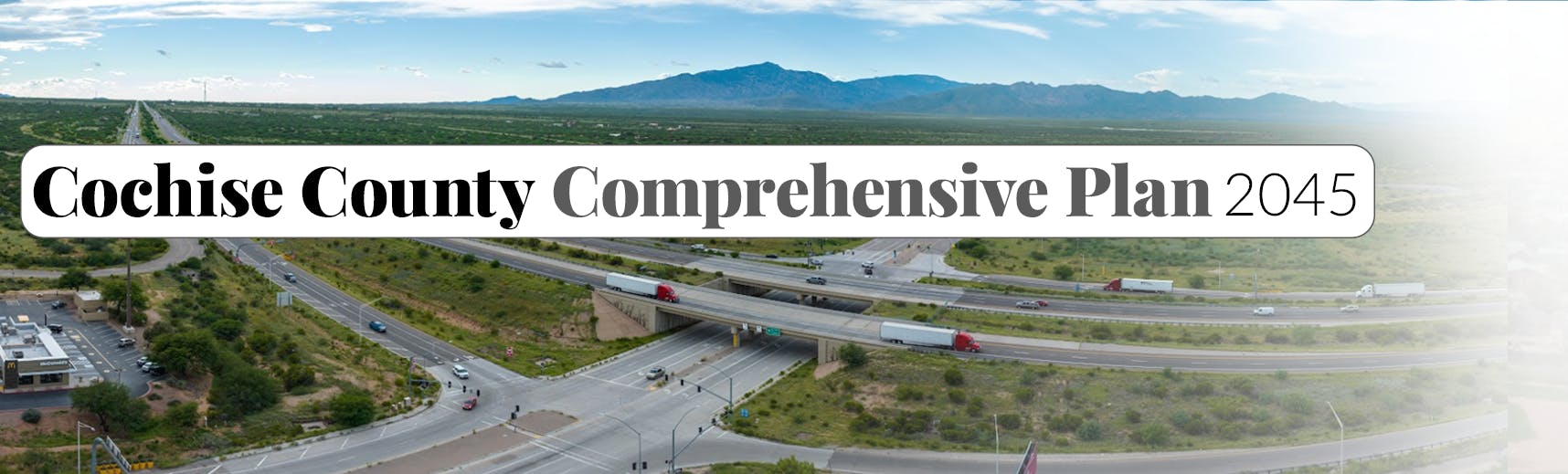
Page last updated: 01 Dec 2025, 01:26 PM