CP 2045 Land Use
A future land use map is a tool that helps guide how Cochise County should grow over the next 10–20 years. It shows the general types of uses—such as homes, businesses, agriculture, industry, open space, and recreation—that are appropriate in different areas. The map is not zoning, but it provides a big-picture vision to help the County make consistent and informed decisions as new development proposals come forward.
Cochise County uses the future land use map to:
- Direct growth to appropriate locations
- Protect natural, cultural, and scenic areas
- Support safe, healthy, and livable communities
The map also considers important factors such as Fort Huachuca operations, flood hazards, and federal or state lands to help ensure new development is compatible with surrounding conditions and existing infrastructure.


For a more detailed look at these maps, visit the County's Development Services Spatial Information/Maps webpage.
PROPOSED LAND USE GOALS & POLICIES
GOAL 1: Smart Growth, Right Places
- Grow where services already exist and protect rural areas.
- Focus infrastructure upgrades in Growth Areas A–C
- Reuse underused or brownfield sites before expanding into new land
- Improve roads, parking, broadband, and signage in tourism corridors
GOAL 2: Investing in People, Powering Industry
- Support local jobs and strengthen the regional economy.
- Expand vocational training, apprenticeships, and career programs
- Strengthen regional and cross-border trade
- Support key industries: defense, aerospace, agriculture, viticulture, and healthcare
GOAL 3: Showcase Cochise
- Promote tourism, history, outdoor recreation, and local culture.
- Support adaptive reuse of historic buildings
- Improve trails, wayfinding, and cultural/heritage sites
- Promote local festivals and community events
- Encourage dark-sky tourism and protect night skies
GOAL 4: Healthy Land, Healthy Life
- Protect natural landscapes, wildlife, and working lands.
- Encourage scenic easements to preserve views and open space
- Support wildlife corridors and voluntary conservation practices on farms
GOAL 5: Power from the Sun
- Make Cochise County a leader in solar energy.
- Ensure new development maintains strong solar access
- Add solar or solar-ready features to public buildings
- Encourage solar-ready home construction with low-cost design options
- Support renewable energy projects that create local jobs
GOAL 6: Rocks, Resources, Resilience
- Plan for compatible and safe use of mining and aggregate resources.
- Maintain a GIS map of mineral and aggregate areas
- Create appropriate buffer zones in high-potential mining areas
- Allow mining and processing in industrial zones when compatible
GOAL 7: High-Flying Safety, Grounded Planning
- Keep development compatible with military missions and safety zones.
- Limit residential development in high-noise and accident-potential zones
- Keep densities low where safety risks are higher
- Encourage industrial or agricultural uses where they best fit
GOAL 8: Every Community Counts
- Ensure all communities have a voice in planning decisions.
- Replace outdated Area Plans with new Community Area Profiles
- Provide consistent, accessible information for all regions
- Use profiles to guide planning and zoning decisions
- Update profiles as conditions and community values change
GOAL 9: Working Landscapes, Coordinated Land Use
- Protect agriculture and guide growth responsibly.
- Preserve ranching and farming as essential working landscapes
- Avoid development in high-risk hazard areas
- Coordinate closely with cities, towns, military, and state/federal partners
A future land use map is a tool that helps guide how Cochise County should grow over the next 10–20 years. It shows the general types of uses—such as homes, businesses, agriculture, industry, open space, and recreation—that are appropriate in different areas. The map is not zoning, but it provides a big-picture vision to help the County make consistent and informed decisions as new development proposals come forward.
Cochise County uses the future land use map to:
- Direct growth to appropriate locations
- Protect natural, cultural, and scenic areas
- Support safe, healthy, and livable communities
The map also considers important factors such as Fort Huachuca operations, flood hazards, and federal or state lands to help ensure new development is compatible with surrounding conditions and existing infrastructure.
For a more detailed look at these maps, visit the County's Development Services Spatial Information/Maps webpage.
PROPOSED LAND USE GOALS & POLICIES
GOAL 1: Smart Growth, Right Places
- Grow where services already exist and protect rural areas.
- Focus infrastructure upgrades in Growth Areas A–C
- Reuse underused or brownfield sites before expanding into new land
- Improve roads, parking, broadband, and signage in tourism corridors
GOAL 2: Investing in People, Powering Industry
- Support local jobs and strengthen the regional economy.
- Expand vocational training, apprenticeships, and career programs
- Strengthen regional and cross-border trade
- Support key industries: defense, aerospace, agriculture, viticulture, and healthcare
GOAL 3: Showcase Cochise
- Promote tourism, history, outdoor recreation, and local culture.
- Support adaptive reuse of historic buildings
- Improve trails, wayfinding, and cultural/heritage sites
- Promote local festivals and community events
- Encourage dark-sky tourism and protect night skies
GOAL 4: Healthy Land, Healthy Life
- Protect natural landscapes, wildlife, and working lands.
- Encourage scenic easements to preserve views and open space
- Support wildlife corridors and voluntary conservation practices on farms
GOAL 5: Power from the Sun
- Make Cochise County a leader in solar energy.
- Ensure new development maintains strong solar access
- Add solar or solar-ready features to public buildings
- Encourage solar-ready home construction with low-cost design options
- Support renewable energy projects that create local jobs
GOAL 6: Rocks, Resources, Resilience
- Plan for compatible and safe use of mining and aggregate resources.
- Maintain a GIS map of mineral and aggregate areas
- Create appropriate buffer zones in high-potential mining areas
- Allow mining and processing in industrial zones when compatible
GOAL 7: High-Flying Safety, Grounded Planning
- Keep development compatible with military missions and safety zones.
- Limit residential development in high-noise and accident-potential zones
- Keep densities low where safety risks are higher
- Encourage industrial or agricultural uses where they best fit
GOAL 8: Every Community Counts
- Ensure all communities have a voice in planning decisions.
- Replace outdated Area Plans with new Community Area Profiles
- Provide consistent, accessible information for all regions
- Use profiles to guide planning and zoning decisions
- Update profiles as conditions and community values change
GOAL 9: Working Landscapes, Coordinated Land Use
- Protect agriculture and guide growth responsibly.
- Preserve ranching and farming as essential working landscapes
- Avoid development in high-risk hazard areas
- Coordinate closely with cities, towns, military, and state/federal partners
We want to hear from you. Please share comments that help improve the draft Land Use Element and the Future Land Use Map.
Comments should focus on:
- Growth Areas (A–D): Are the boundaries appropriate? Do they reflect where services and infrastructure exist?
- Future Land Use Map: Are the land use categories and locations accurate for your community?
- Goals & Policies: Are the nine land use goals clear and appropriate? Is anything missing or unclear?
- Community Impacts: Will the proposed land use direction support your community’s needs—housing, jobs, rural character, agriculture, environment?
- Specific Corrections: If a boundary, label, or map feature looks incorrect, please tell us where.
- Local Knowledge: Share on-the-ground insights about access, flooding, traffic, resources, or unique neighborhood characteristics.
Tips for Helpful Comments:
- Be as specific as possible—note locations, intersections, parcel areas, or communities.
- If referring to a map, include the map section or Growth Area letter.
- Share why you support or disagree with something.
- Keep comments focused on land use, growth areas, and map accuracy.
How to comment:
- Type your comment in the text box below (where it states "Ask a question...")
- Comments can also be emailed to: developmentservices@cochise.az.gov, subject line "CP2045 comments"
Note: Your comments will help ensure the Land Use Element reflects our community priorities. Thank you!
-
Share Is it feasible to Dam up the BLM at the San Pedro River an make it a nice lake to fish, camp and swim at? This would help with the water in Cochise County also bring in revenue to the area and also water for any farmers that want to plant crops. on Facebook Share Is it feasible to Dam up the BLM at the San Pedro River an make it a nice lake to fish, camp and swim at? This would help with the water in Cochise County also bring in revenue to the area and also water for any farmers that want to plant crops. on Twitter Share Is it feasible to Dam up the BLM at the San Pedro River an make it a nice lake to fish, camp and swim at? This would help with the water in Cochise County also bring in revenue to the area and also water for any farmers that want to plant crops. on Linkedin Email Is it feasible to Dam up the BLM at the San Pedro River an make it a nice lake to fish, camp and swim at? This would help with the water in Cochise County also bring in revenue to the area and also water for any farmers that want to plant crops. link
Is it feasible to Dam up the BLM at the San Pedro River an make it a nice lake to fish, camp and swim at? This would help with the water in Cochise County also bring in revenue to the area and also water for any farmers that want to plant crops.
John zuniga asked about 1 year agoThank you for your suggestion. Creating a dam on the San Pedro River is not feasible, because it is a protected riparian area with critical habitat and federally designated conservation status. Here’s a little more info about the river, published by BLM: https://www.blm.gov/national-conservation-lands/arizona/san-pedro
-
Share THE CURRENT LAND USE MAP SHOWS VARIOUS COLORS OF LAND USE, HOWEVER, THERE IS NO EXPLANATION OF WHAT THESE TITLES MEAN. THERE IS NO SUCH AGENCY AS US GAME AND FISH. DO YOU MEAN US FISH AND WILDLIFE SERVICE OR ARIZONA GAME AND FISH DEPARTMENT? NEITHER ONE IS DEPICTED ON THE MAP. on Facebook Share THE CURRENT LAND USE MAP SHOWS VARIOUS COLORS OF LAND USE, HOWEVER, THERE IS NO EXPLANATION OF WHAT THESE TITLES MEAN. THERE IS NO SUCH AGENCY AS US GAME AND FISH. DO YOU MEAN US FISH AND WILDLIFE SERVICE OR ARIZONA GAME AND FISH DEPARTMENT? NEITHER ONE IS DEPICTED ON THE MAP. on Twitter Share THE CURRENT LAND USE MAP SHOWS VARIOUS COLORS OF LAND USE, HOWEVER, THERE IS NO EXPLANATION OF WHAT THESE TITLES MEAN. THERE IS NO SUCH AGENCY AS US GAME AND FISH. DO YOU MEAN US FISH AND WILDLIFE SERVICE OR ARIZONA GAME AND FISH DEPARTMENT? NEITHER ONE IS DEPICTED ON THE MAP. on Linkedin Email THE CURRENT LAND USE MAP SHOWS VARIOUS COLORS OF LAND USE, HOWEVER, THERE IS NO EXPLANATION OF WHAT THESE TITLES MEAN. THERE IS NO SUCH AGENCY AS US GAME AND FISH. DO YOU MEAN US FISH AND WILDLIFE SERVICE OR ARIZONA GAME AND FISH DEPARTMENT? NEITHER ONE IS DEPICTED ON THE MAP. link
THE CURRENT LAND USE MAP SHOWS VARIOUS COLORS OF LAND USE, HOWEVER, THERE IS NO EXPLANATION OF WHAT THESE TITLES MEAN. THERE IS NO SUCH AGENCY AS US GAME AND FISH. DO YOU MEAN US FISH AND WILDLIFE SERVICE OR ARIZONA GAME AND FISH DEPARTMENT? NEITHER ONE IS DEPICTED ON THE MAP.
OldTimer asked about 1 year agoThank you for your comment. The map key on page 38 of the draft plan clarifies that this category represents U.S. Fish and Wildlife Service lands, not Arizona Game and Fish. We appreciate your careful review.
-
Share I understand that water policy cannot be determined solely at the county level. However, your answer to the question below does not address supporting agriculture. Local economies are supported by agriculture, not the other way round, and we force agriculture out at our peril. on Facebook Share I understand that water policy cannot be determined solely at the county level. However, your answer to the question below does not address supporting agriculture. Local economies are supported by agriculture, not the other way round, and we force agriculture out at our peril. on Twitter Share I understand that water policy cannot be determined solely at the county level. However, your answer to the question below does not address supporting agriculture. Local economies are supported by agriculture, not the other way round, and we force agriculture out at our peril. on Linkedin Email I understand that water policy cannot be determined solely at the county level. However, your answer to the question below does not address supporting agriculture. Local economies are supported by agriculture, not the other way round, and we force agriculture out at our peril. link
I understand that water policy cannot be determined solely at the county level. However, your answer to the question below does not address supporting agriculture. Local economies are supported by agriculture, not the other way round, and we force agriculture out at our peril.
Sonia Gasho asked about 1 year agoThank you for your comment. Cochise County’s Comprehensive Plan includes policies that support agriculture by protecting farmland, encouraging sustainable irrigation practices, and promoting agri-tourism and local markets. These policies are designed to help agriculture thrive while balancing water conservation and long-term community growth.
-
Share Stop allowing developers to overbuild. Segments of the county are at risk of running out of water. Some wells are already going dry. on Facebook Share Stop allowing developers to overbuild. Segments of the county are at risk of running out of water. Some wells are already going dry. on Twitter Share Stop allowing developers to overbuild. Segments of the county are at risk of running out of water. Some wells are already going dry. on Linkedin Email Stop allowing developers to overbuild. Segments of the county are at risk of running out of water. Some wells are already going dry. link
Stop allowing developers to overbuild. Segments of the county are at risk of running out of water. Some wells are already going dry.
GreggAPowell asked about 1 year agoThank you for your concern. Cochise County prioritizes growth in areas with adequate water and infrastructure and limits high-density development in rural or water-sensitive areas. However, the County has limited authority over private wells and certain exempt uses like agriculture and mining, so we focus on guidance, coordination, and sustainable planning where we can.
-
Share suggestions related to land use: Cochise County’s diverse landscapes and strategic location offer tremendous potential for sustainable development, economic growth, and community enrichment. Below are key land-use recommendations aligned with the CP 2045 vision: 1. Economic Development Zones Logistics and Trade Hubs: Expand industrial zones near the Douglas Port of Entry to support freight movement, warehousing, and distribution centers. Establish Foreign Trade Zones (FTZs) to attract manufacturing companies and export-driven industries. Innovation and Technology Parks: Designate land for AI research centers, data centers, and autonomous vehicle testing zones to position Cochise County as a technology leader. 2. Renewable Energy Zones Develop solar farms, wind parks, and hydrogen fueling stations in low-impact desert areas to create renewable energy corridors. Promote microgrids and battery storage systems to support energy resilience and off-grid housing developments. Provide zoning incentives for green energy businesses and clean technology companies. 3. Housing Growth Areas Mixed-Use Developments: Encourage multi-family housing, live/work spaces, and affordable housing units in urban growth zones to meet future housing needs. Rural and Off-Grid Housing: Support off-grid communities and eco-friendly housing developments with sustainable water and solar systems. Retirement Communities: Allocate land for active adult communities, RV parks, and senior living facilities to support retiring populations. 4. Tourism and Recreation Areas Cultural and Historical Preservation: Protect and promote historic landmarks, ghost towns, and archaeological sites for heritage tourism. Eco-Tourism Parks: Develop nature trails, campgrounds, and wildlife sanctuaries to attract eco-tourists and preserve natural habitats. Entertainment Hubs: Create theaters, festival grounds, and event venues to boost arts and culture. 5. Agricultural Preservation Zones Smart Agriculture Practices: Protect fertile farmlands by promoting sustainable irrigation and crop diversification programs. Agri-Tourism Initiatives: Designate areas for farm-to-table markets, wineries, and agricultural festivals to boost local economies. 6. Transportation and Connectivity Hubs Multi-Modal Transport Centers: Expand rail terminals, highway rest stops, and EV charging stations to support cross-border trade and commuter growth. Airport Expansion: Support the expansion of Bisbee-Douglas International Airport for direct flights to major business hubs (Dallas, Atlanta, Seattle, Phoenix). Bike and Pedestrian Paths: Develop bike lanes and multi-use trails connecting urban growth areas to rural communities. 7. Water Resource Management Areas Develop rainwater harvesting systems, wastewater recycling, and flood control basins to address water scarcity. Promote low-water landscaping and native plant restoration to balance growth with conservation efforts. Implement zoning policies that limit high water usage developments in fragile areas. 8. Emergency Preparedness Zones Create disaster relief hubs and emergency shelters to support residents during wildfires and flooding events. Integrate AI surveillance systems and drone technology for early-warning alerts and rapid response. 9. Scenic and Conservation Corridors Propose scenic road designations (e.g., Highway 80, US-191 and Chiricahua routes) to boost tourism and preserve natural beauty. Develop open space corridors and wildlife protection areas to balance development with environmental conservation. 10. Smart Growth Incentives Provide density bonuses, tax breaks, and grants for developers building eco-friendly, high-density housing and mixed-use communities. Streamline zoning approvals for green projects, modular homes, and affordable housing developments. These land-use recommendations align with Cochise County’s long-term vision by balancing growth, sustainability, and economic expansion. To ensure that the county should be prepared to meet the needs of future generations while preserving its heritage and natural resources. on Facebook Share suggestions related to land use: Cochise County’s diverse landscapes and strategic location offer tremendous potential for sustainable development, economic growth, and community enrichment. Below are key land-use recommendations aligned with the CP 2045 vision: 1. Economic Development Zones Logistics and Trade Hubs: Expand industrial zones near the Douglas Port of Entry to support freight movement, warehousing, and distribution centers. Establish Foreign Trade Zones (FTZs) to attract manufacturing companies and export-driven industries. Innovation and Technology Parks: Designate land for AI research centers, data centers, and autonomous vehicle testing zones to position Cochise County as a technology leader. 2. Renewable Energy Zones Develop solar farms, wind parks, and hydrogen fueling stations in low-impact desert areas to create renewable energy corridors. Promote microgrids and battery storage systems to support energy resilience and off-grid housing developments. Provide zoning incentives for green energy businesses and clean technology companies. 3. Housing Growth Areas Mixed-Use Developments: Encourage multi-family housing, live/work spaces, and affordable housing units in urban growth zones to meet future housing needs. Rural and Off-Grid Housing: Support off-grid communities and eco-friendly housing developments with sustainable water and solar systems. Retirement Communities: Allocate land for active adult communities, RV parks, and senior living facilities to support retiring populations. 4. Tourism and Recreation Areas Cultural and Historical Preservation: Protect and promote historic landmarks, ghost towns, and archaeological sites for heritage tourism. Eco-Tourism Parks: Develop nature trails, campgrounds, and wildlife sanctuaries to attract eco-tourists and preserve natural habitats. Entertainment Hubs: Create theaters, festival grounds, and event venues to boost arts and culture. 5. Agricultural Preservation Zones Smart Agriculture Practices: Protect fertile farmlands by promoting sustainable irrigation and crop diversification programs. Agri-Tourism Initiatives: Designate areas for farm-to-table markets, wineries, and agricultural festivals to boost local economies. 6. Transportation and Connectivity Hubs Multi-Modal Transport Centers: Expand rail terminals, highway rest stops, and EV charging stations to support cross-border trade and commuter growth. Airport Expansion: Support the expansion of Bisbee-Douglas International Airport for direct flights to major business hubs (Dallas, Atlanta, Seattle, Phoenix). Bike and Pedestrian Paths: Develop bike lanes and multi-use trails connecting urban growth areas to rural communities. 7. Water Resource Management Areas Develop rainwater harvesting systems, wastewater recycling, and flood control basins to address water scarcity. Promote low-water landscaping and native plant restoration to balance growth with conservation efforts. Implement zoning policies that limit high water usage developments in fragile areas. 8. Emergency Preparedness Zones Create disaster relief hubs and emergency shelters to support residents during wildfires and flooding events. Integrate AI surveillance systems and drone technology for early-warning alerts and rapid response. 9. Scenic and Conservation Corridors Propose scenic road designations (e.g., Highway 80, US-191 and Chiricahua routes) to boost tourism and preserve natural beauty. Develop open space corridors and wildlife protection areas to balance development with environmental conservation. 10. Smart Growth Incentives Provide density bonuses, tax breaks, and grants for developers building eco-friendly, high-density housing and mixed-use communities. Streamline zoning approvals for green projects, modular homes, and affordable housing developments. These land-use recommendations align with Cochise County’s long-term vision by balancing growth, sustainability, and economic expansion. To ensure that the county should be prepared to meet the needs of future generations while preserving its heritage and natural resources. on Twitter Share suggestions related to land use: Cochise County’s diverse landscapes and strategic location offer tremendous potential for sustainable development, economic growth, and community enrichment. Below are key land-use recommendations aligned with the CP 2045 vision: 1. Economic Development Zones Logistics and Trade Hubs: Expand industrial zones near the Douglas Port of Entry to support freight movement, warehousing, and distribution centers. Establish Foreign Trade Zones (FTZs) to attract manufacturing companies and export-driven industries. Innovation and Technology Parks: Designate land for AI research centers, data centers, and autonomous vehicle testing zones to position Cochise County as a technology leader. 2. Renewable Energy Zones Develop solar farms, wind parks, and hydrogen fueling stations in low-impact desert areas to create renewable energy corridors. Promote microgrids and battery storage systems to support energy resilience and off-grid housing developments. Provide zoning incentives for green energy businesses and clean technology companies. 3. Housing Growth Areas Mixed-Use Developments: Encourage multi-family housing, live/work spaces, and affordable housing units in urban growth zones to meet future housing needs. Rural and Off-Grid Housing: Support off-grid communities and eco-friendly housing developments with sustainable water and solar systems. Retirement Communities: Allocate land for active adult communities, RV parks, and senior living facilities to support retiring populations. 4. Tourism and Recreation Areas Cultural and Historical Preservation: Protect and promote historic landmarks, ghost towns, and archaeological sites for heritage tourism. Eco-Tourism Parks: Develop nature trails, campgrounds, and wildlife sanctuaries to attract eco-tourists and preserve natural habitats. Entertainment Hubs: Create theaters, festival grounds, and event venues to boost arts and culture. 5. Agricultural Preservation Zones Smart Agriculture Practices: Protect fertile farmlands by promoting sustainable irrigation and crop diversification programs. Agri-Tourism Initiatives: Designate areas for farm-to-table markets, wineries, and agricultural festivals to boost local economies. 6. Transportation and Connectivity Hubs Multi-Modal Transport Centers: Expand rail terminals, highway rest stops, and EV charging stations to support cross-border trade and commuter growth. Airport Expansion: Support the expansion of Bisbee-Douglas International Airport for direct flights to major business hubs (Dallas, Atlanta, Seattle, Phoenix). Bike and Pedestrian Paths: Develop bike lanes and multi-use trails connecting urban growth areas to rural communities. 7. Water Resource Management Areas Develop rainwater harvesting systems, wastewater recycling, and flood control basins to address water scarcity. Promote low-water landscaping and native plant restoration to balance growth with conservation efforts. Implement zoning policies that limit high water usage developments in fragile areas. 8. Emergency Preparedness Zones Create disaster relief hubs and emergency shelters to support residents during wildfires and flooding events. Integrate AI surveillance systems and drone technology for early-warning alerts and rapid response. 9. Scenic and Conservation Corridors Propose scenic road designations (e.g., Highway 80, US-191 and Chiricahua routes) to boost tourism and preserve natural beauty. Develop open space corridors and wildlife protection areas to balance development with environmental conservation. 10. Smart Growth Incentives Provide density bonuses, tax breaks, and grants for developers building eco-friendly, high-density housing and mixed-use communities. Streamline zoning approvals for green projects, modular homes, and affordable housing developments. These land-use recommendations align with Cochise County’s long-term vision by balancing growth, sustainability, and economic expansion. To ensure that the county should be prepared to meet the needs of future generations while preserving its heritage and natural resources. on Linkedin Email suggestions related to land use: Cochise County’s diverse landscapes and strategic location offer tremendous potential for sustainable development, economic growth, and community enrichment. Below are key land-use recommendations aligned with the CP 2045 vision: 1. Economic Development Zones Logistics and Trade Hubs: Expand industrial zones near the Douglas Port of Entry to support freight movement, warehousing, and distribution centers. Establish Foreign Trade Zones (FTZs) to attract manufacturing companies and export-driven industries. Innovation and Technology Parks: Designate land for AI research centers, data centers, and autonomous vehicle testing zones to position Cochise County as a technology leader. 2. Renewable Energy Zones Develop solar farms, wind parks, and hydrogen fueling stations in low-impact desert areas to create renewable energy corridors. Promote microgrids and battery storage systems to support energy resilience and off-grid housing developments. Provide zoning incentives for green energy businesses and clean technology companies. 3. Housing Growth Areas Mixed-Use Developments: Encourage multi-family housing, live/work spaces, and affordable housing units in urban growth zones to meet future housing needs. Rural and Off-Grid Housing: Support off-grid communities and eco-friendly housing developments with sustainable water and solar systems. Retirement Communities: Allocate land for active adult communities, RV parks, and senior living facilities to support retiring populations. 4. Tourism and Recreation Areas Cultural and Historical Preservation: Protect and promote historic landmarks, ghost towns, and archaeological sites for heritage tourism. Eco-Tourism Parks: Develop nature trails, campgrounds, and wildlife sanctuaries to attract eco-tourists and preserve natural habitats. Entertainment Hubs: Create theaters, festival grounds, and event venues to boost arts and culture. 5. Agricultural Preservation Zones Smart Agriculture Practices: Protect fertile farmlands by promoting sustainable irrigation and crop diversification programs. Agri-Tourism Initiatives: Designate areas for farm-to-table markets, wineries, and agricultural festivals to boost local economies. 6. Transportation and Connectivity Hubs Multi-Modal Transport Centers: Expand rail terminals, highway rest stops, and EV charging stations to support cross-border trade and commuter growth. Airport Expansion: Support the expansion of Bisbee-Douglas International Airport for direct flights to major business hubs (Dallas, Atlanta, Seattle, Phoenix). Bike and Pedestrian Paths: Develop bike lanes and multi-use trails connecting urban growth areas to rural communities. 7. Water Resource Management Areas Develop rainwater harvesting systems, wastewater recycling, and flood control basins to address water scarcity. Promote low-water landscaping and native plant restoration to balance growth with conservation efforts. Implement zoning policies that limit high water usage developments in fragile areas. 8. Emergency Preparedness Zones Create disaster relief hubs and emergency shelters to support residents during wildfires and flooding events. Integrate AI surveillance systems and drone technology for early-warning alerts and rapid response. 9. Scenic and Conservation Corridors Propose scenic road designations (e.g., Highway 80, US-191 and Chiricahua routes) to boost tourism and preserve natural beauty. Develop open space corridors and wildlife protection areas to balance development with environmental conservation. 10. Smart Growth Incentives Provide density bonuses, tax breaks, and grants for developers building eco-friendly, high-density housing and mixed-use communities. Streamline zoning approvals for green projects, modular homes, and affordable housing developments. These land-use recommendations align with Cochise County’s long-term vision by balancing growth, sustainability, and economic expansion. To ensure that the county should be prepared to meet the needs of future generations while preserving its heritage and natural resources. link
suggestions related to land use: Cochise County’s diverse landscapes and strategic location offer tremendous potential for sustainable development, economic growth, and community enrichment. Below are key land-use recommendations aligned with the CP 2045 vision: 1. Economic Development Zones Logistics and Trade Hubs: Expand industrial zones near the Douglas Port of Entry to support freight movement, warehousing, and distribution centers. Establish Foreign Trade Zones (FTZs) to attract manufacturing companies and export-driven industries. Innovation and Technology Parks: Designate land for AI research centers, data centers, and autonomous vehicle testing zones to position Cochise County as a technology leader. 2. Renewable Energy Zones Develop solar farms, wind parks, and hydrogen fueling stations in low-impact desert areas to create renewable energy corridors. Promote microgrids and battery storage systems to support energy resilience and off-grid housing developments. Provide zoning incentives for green energy businesses and clean technology companies. 3. Housing Growth Areas Mixed-Use Developments: Encourage multi-family housing, live/work spaces, and affordable housing units in urban growth zones to meet future housing needs. Rural and Off-Grid Housing: Support off-grid communities and eco-friendly housing developments with sustainable water and solar systems. Retirement Communities: Allocate land for active adult communities, RV parks, and senior living facilities to support retiring populations. 4. Tourism and Recreation Areas Cultural and Historical Preservation: Protect and promote historic landmarks, ghost towns, and archaeological sites for heritage tourism. Eco-Tourism Parks: Develop nature trails, campgrounds, and wildlife sanctuaries to attract eco-tourists and preserve natural habitats. Entertainment Hubs: Create theaters, festival grounds, and event venues to boost arts and culture. 5. Agricultural Preservation Zones Smart Agriculture Practices: Protect fertile farmlands by promoting sustainable irrigation and crop diversification programs. Agri-Tourism Initiatives: Designate areas for farm-to-table markets, wineries, and agricultural festivals to boost local economies. 6. Transportation and Connectivity Hubs Multi-Modal Transport Centers: Expand rail terminals, highway rest stops, and EV charging stations to support cross-border trade and commuter growth. Airport Expansion: Support the expansion of Bisbee-Douglas International Airport for direct flights to major business hubs (Dallas, Atlanta, Seattle, Phoenix). Bike and Pedestrian Paths: Develop bike lanes and multi-use trails connecting urban growth areas to rural communities. 7. Water Resource Management Areas Develop rainwater harvesting systems, wastewater recycling, and flood control basins to address water scarcity. Promote low-water landscaping and native plant restoration to balance growth with conservation efforts. Implement zoning policies that limit high water usage developments in fragile areas. 8. Emergency Preparedness Zones Create disaster relief hubs and emergency shelters to support residents during wildfires and flooding events. Integrate AI surveillance systems and drone technology for early-warning alerts and rapid response. 9. Scenic and Conservation Corridors Propose scenic road designations (e.g., Highway 80, US-191 and Chiricahua routes) to boost tourism and preserve natural beauty. Develop open space corridors and wildlife protection areas to balance development with environmental conservation. 10. Smart Growth Incentives Provide density bonuses, tax breaks, and grants for developers building eco-friendly, high-density housing and mixed-use communities. Streamline zoning approvals for green projects, modular homes, and affordable housing developments. These land-use recommendations align with Cochise County’s long-term vision by balancing growth, sustainability, and economic expansion. To ensure that the county should be prepared to meet the needs of future generations while preserving its heritage and natural resources.
Sreenu asked over 1 year agoThank you for your thoughtful suggestions. We’ve considered them where possible—many are reflected in CP 2045’s Growth Area Categories, Land Use Designations, and policies—but some ideas are very specific and would need to be addressed through site-specific Master Development Plans, overlays, or future planning efforts. We appreciate your input as we continue to guide sustainable growth and preserve Cochise County’s unique character.
-
Share I live in Tombstone. When there is a change of permitted building, the affected properties should be notified prior to affectingthat cange. They currently are not. on Facebook Share I live in Tombstone. When there is a change of permitted building, the affected properties should be notified prior to affectingthat cange. They currently are not. on Twitter Share I live in Tombstone. When there is a change of permitted building, the affected properties should be notified prior to affectingthat cange. They currently are not. on Linkedin Email I live in Tombstone. When there is a change of permitted building, the affected properties should be notified prior to affectingthat cange. They currently are not. link
I live in Tombstone. When there is a change of permitted building, the affected properties should be notified prior to affectingthat cange. They currently are not.
Meg85638 asked about 1 year agoThank you for your comment. Cochise County’s Comprehensive Plan and land-use regulations do not apply within city limits. To request changes to notification procedures for building permits, residents should contact the Tombstone City Council or Planning Department, as they have authority over permitting and can consider implementing property-owner notifications.
-
Share Does the county have any say in subsidized cattle ranching on public lands, or are these policy decisions made at the state and federal level? on Facebook Share Does the county have any say in subsidized cattle ranching on public lands, or are these policy decisions made at the state and federal level? on Twitter Share Does the county have any say in subsidized cattle ranching on public lands, or are these policy decisions made at the state and federal level? on Linkedin Email Does the county have any say in subsidized cattle ranching on public lands, or are these policy decisions made at the state and federal level? link
Does the county have any say in subsidized cattle ranching on public lands, or are these policy decisions made at the state and federal level?
Anna asked 8 months agoThank you for your question. Cochise County does not control subsidized cattle grazing on public lands; these programs are managed by federal agencies such as the Bureau of Land Management (BLM) and the U.S. Forest Service, and grazing policies are set at the state and federal level.
-
Share I agree with Joanna's concerns below. I don't understand that as we hear reports of the AMA and water issues we haven't been hearing about any kind of restrictions for the large users of our water such as the dairy and nut farms. I understand that they provide jobs and hopefully taxes, but conservation should belong to everyone. The dairy uses more than the entire county. Shouldn't they be held accountable for reducing water usage? on Facebook Share I agree with Joanna's concerns below. I don't understand that as we hear reports of the AMA and water issues we haven't been hearing about any kind of restrictions for the large users of our water such as the dairy and nut farms. I understand that they provide jobs and hopefully taxes, but conservation should belong to everyone. The dairy uses more than the entire county. Shouldn't they be held accountable for reducing water usage? on Twitter Share I agree with Joanna's concerns below. I don't understand that as we hear reports of the AMA and water issues we haven't been hearing about any kind of restrictions for the large users of our water such as the dairy and nut farms. I understand that they provide jobs and hopefully taxes, but conservation should belong to everyone. The dairy uses more than the entire county. Shouldn't they be held accountable for reducing water usage? on Linkedin Email I agree with Joanna's concerns below. I don't understand that as we hear reports of the AMA and water issues we haven't been hearing about any kind of restrictions for the large users of our water such as the dairy and nut farms. I understand that they provide jobs and hopefully taxes, but conservation should belong to everyone. The dairy uses more than the entire county. Shouldn't they be held accountable for reducing water usage? link
I agree with Joanna's concerns below. I don't understand that as we hear reports of the AMA and water issues we haven't been hearing about any kind of restrictions for the large users of our water such as the dairy and nut farms. I understand that they provide jobs and hopefully taxes, but conservation should belong to everyone. The dairy uses more than the entire county. Shouldn't they be held accountable for reducing water usage?
Debbie asked about 1 year agoThank you for your comments. Many have expressed similar concerns regarding this issues. While Cochise County's direct authority to regulate water usage is limited, in recent months, the Arizona Attorney General has taken steps to address excessive groundwater pumping by corporate farms, indicating a growing recognition of the need for regulatory action at the state level. In addition, the county can partnering with state agencies like ADWR to promote more stringent groundwater management strategies related to large-scale water users.
-
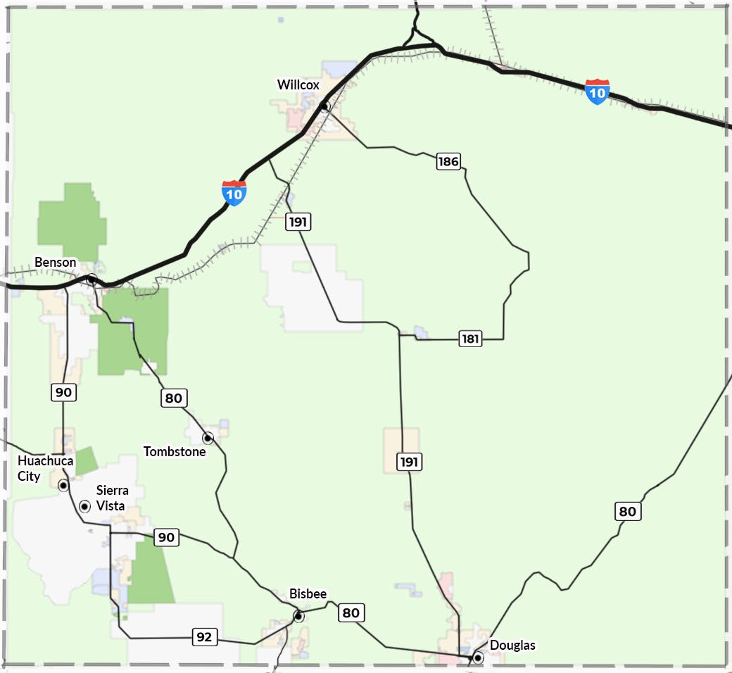
Share Open up a route to Paramour Crater and allow Douglas to offer tours. on Facebook Share Open up a route to Paramour Crater and allow Douglas to offer tours. on Twitter Share Open up a route to Paramour Crater and allow Douglas to offer tours. on Linkedin Email Open up a route to Paramour Crater and allow Douglas to offer tours. link
Open up a route to Paramour Crater and allow Douglas to offer tours.
Raber asked about 1 year agoThanks, what an interesting destination. I will pass this idea along to the city of Douglas!
-
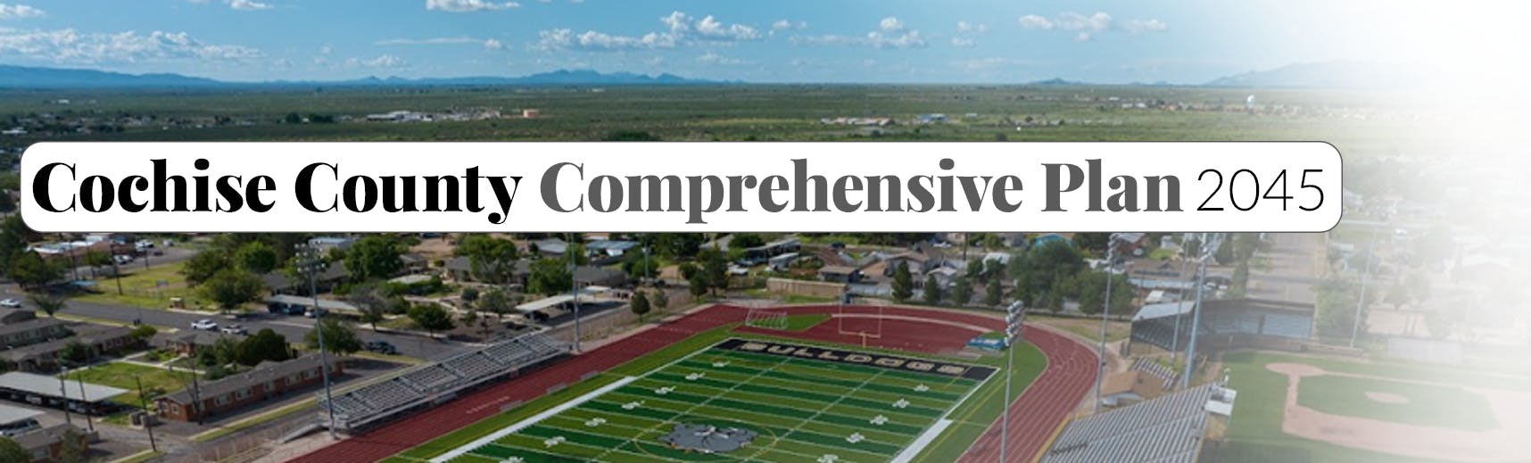
Share Is that football field in the title picture and the green fields behind it in Cochise county? on Facebook Share Is that football field in the title picture and the green fields behind it in Cochise county? on Twitter Share Is that football field in the title picture and the green fields behind it in Cochise county? on Linkedin Email Is that football field in the title picture and the green fields behind it in Cochise county? link
Is that football field in the title picture and the green fields behind it in Cochise county?
MsDoabunch asked about 1 year agoThat is the beautiful home field for the Douglas bulldogs.


Thank you for your contribution!
Help us reach out to more people in the community
Share this with family and friends